Whether it be journalism, academic research, investigations or old-fashioned problem-solving, the 5W’s – who, what, where, when and why – have become the standard expectation for evaluating and communicating a situation. Most nonprofits across the nation can rely on their passion and expertise to articulate who they serve, what they add to those people’s lives, when they do it and why. But many often struggle with articulating “where” they make a difference geographically.
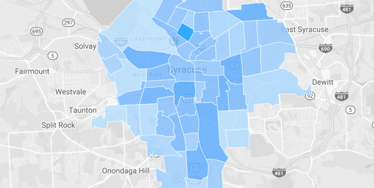
The importance of this distinction locally became most apparent after a national report ranked Syracuse as the worst in the nation for concentrated poverty among certain racial groups. This study found that our poverty numbers are worse in very specific concentrated geographies, but not within the entire city. This infamy has caused funders, nonprofit directors and community leaders to wonder whether the funding and resources they are devoting to address critical community issues are actually making it to the highest need neighborhoods. Likewise, it has made it more important for those implementing programs on the front lines to have better information regarding whether their outreach efforts are actually penetrating those key areas.
In the past, organizations relied on zip codes to analyze their work but this broad measure was simply a rough approximation that was considered “good enough.” Now that we see the difference a few miles can make, it is not effective to combine suburban neighborhoods with high-need urban tracts that, while sharing a zip code, appear worlds apart in terms of their needs and assets. Fortunately, the federal government now offers updated technology to help organizations address this challenge.
The U.S. Census Geocoder website (https://geocoding.geo.census.gov/) has been re-vamped to allow organizations to geocode up to 10,000 addresses at once. This enables them to quickly convert their long address lists into an easy-to-summarize dataset that groups people by neighborhoods. Furthermore, when they look at census data showing how many people are living in poverty, are unemployed or simply fall into a certain age group within a census tract neighborhood, they will also be able to say how many people they serve in that same region.
With this tool at our community’s disposal it won’t be long before sharing “where” we serve is just as common and precise as our efforts to talk about who, when, why and how we serve them.
